Home Information Pictures Maps Google Map Visit the fault Earthquakes Be Prepared ShakeOut! Feel it?
Big One Tectonics Volcanoes Tsunamis History Myths Organizations Links About Research

The San Andreas fault's nick name is "SAF".
California Geology
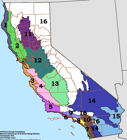
Geomorphic provinces, geologic map and climate map of California
|
|
California's vast geographic and climatic character is also due to tectonics. The Sierra Nevada create uplift of moist oceanic air masses and it rains. Much of the water reaches the San Joaquin valley but by the time the storms reach the eastern Sierra and Owens Valley, most of the water has been wrung from the clouds. The White and Inyo mountains, only twenty five miles east of the Sierra crest, are semi-arid. They suck the remaining water from the skies and by the time the air reaches the Saline and Death Valleys, it is bone dry. Such weather patterns have a great influence on the surface geology as well: erosion, deposition and chemical alternation take place rapidly in many parts of California. The rainiest and most arid places in California are in Del Norte County near Gasquet (92 inches per year), and the Death Valley desert (1.8 inches/year), respectively. Death Valley holds the record for the highest temperature (134 F) in North America, second only to Libya's world record (136 F). Another reason California is so geologically-diverse is because it is big. The bigger the state, the more likely it is to encompass interesting geology. Only Alaska is larger and more varied, and it is four time larger than California. Both states have eight National Parks - more than any other states - and the parks are draped over some of the most spectacular geological scenery in the world. Like California, Alaska is a tectonically active region. California's state rock, mineral and gem are all products of tectonics: serpentine, gold and benitoite. |
California Geology by Deborah Harden
New (2010) California Fault Activity Map (CGS)
New (2010) interactive CGS Geological Map of California
150 Geologic Facts about California (CGS - Downloads a PDF)
QFaults kmz files (Google Earth files) of faults in the western US.
GEOLOGY.COM's California page
Bay area geology
California Geomorphic Provinces
Wikipedia California Atlas page
California Landslide Susceptibility Map (PDF)
California coastal tsunami inundation map (CGS)
California geological map
CERES: California's Natural Resources
USGS Desert geology website
Please help us make this site better. Email us suggestions, pictures, links, etc. here.
Copyright � 2009, 2010 David K. Lynch. All Rights Reserved.
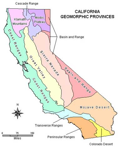
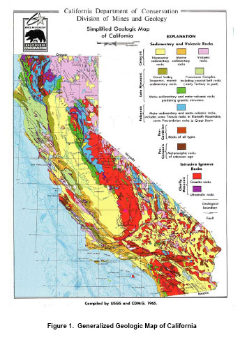
 Thanks to the San Andreas fault - and in a larger sense plate tectonics - California is one of the most geologically complex places in the world. The state contains many major tectonic features: